|
BANKSTOWN AIRPORT CRASH DANGERS
Near Miss and Fatal Crashes
|
 |
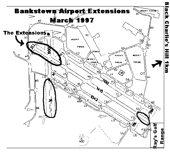
GPS Testing - Low FlyerOn 28th May, 1998 a resident of Condell Park was alarmed by a light aircraft flying an unusual path at dangerously low altitude. The resident and neighbours estimated it at less than 30 meters (100 feet) altitude. The aircraft had barely cleared Black Charlie's Hill, on the North Eastern corner of Bankstown Airport, and appeared to be losing altitude after scraping over the Hill.Hiding But Proving ExpansionIn a reply to the resident's complaint, CASA (Civil Aviation Safety Authority, a brother government department to the Federal Airports Corporation and Airservices Australia) revealed that the plane was being flown by Airservices Australia staff who were validating GPS instrument flight approach equipment. The Second Sydney Airport Draft EIS listed lack of instrument flight capabilities as one of the reasons Bankstown Airport was not a reasonable alternative to a Second Airport.Now, in spite of claims by airport managers that Bankstown Airport is not expanding, CASA have provided clear evidence of plans to add instrument capabilities to Bankstown Airport. If this is not expanding the airport, what is ? What other first steps do you need to take to support routine regional airline services into Bankstown ? Risks to ResidentsWhy was the plane on such a dangerous path ? It turns out that the validation exercise required the pilot to fly unusual routes to check obstacle heights etc.,. At the time of the incident, the aircraft had taken off in the opposite direction to the normal flow at that time.
As the aircraft was taking off runway 11C (center runway, on heading 110 deg clockwise from North), the Air Traffic Controller issued
an urgent direction to the aircraft to "turn left,
do not acknowledge".
The aircraft was only half-way down the runway, and was at approximately 100 foot altitude - not even half the height of Black Charlie's Hill.
The order "do not acknowledge" is ATC language for "do it now, you are about to crash, you don't have time to acknowledge, and we don't have enough time to use these fancy words". A crash was imminent. Together with the fatal June 6th mid-air collision between two light aircraft doing training flights between Bankstown and Hoxton Park Airports, and the Sunday 5th May 2002 crash at Bankstown which killed 4 people, this highlights the stupidity of conducting experimental flying in densely populated residential areas. It is also indicative of the lack of regard that pilots & airport bureaucrats have for local residents. Airport Managers seriously underestimated the danger of the validating exercise. Why didn't they take steps to suspend normal operations while they were being carried out ? As well, why weren't residents notified of the plans to test these instrument capabilities ? Why shouldn't these plans be explained to us, in the light of concerns about airport expansions ? Are they scared we'll discover the truth of what they are up to ? What are they hiding ?. As the next incident shows, when near-misses are ignored, they turn into fatalities... Maximising Bankstown Crash DangersTo highlight the airport dangers, around 3:25 pm on Sunday 5th May 2002, a family of four died instantly when their light Piper Cherokee Warrior PA28-161 aircraft collided with a Socata Tobago TB10 trainer aircraft on the approach to Bankstown Airport (see ATSB preliminary report for Occurrence 200201846). The collision occurred on the Southern side of the airport on a weekend, only blocks away from high schools, a hospital and the crowded M5 motorway. Fortunately, the Piper aircraft plummeted to the ground in an unoccupied carpark of an industrial estate. The pilot training school was quick to deny any responsibility for the accident, obviously fearful that the community might question the stupidity of touch-and-go circuit training of pilots over densely populated urban areas. Where else in the Western World do cities of 4.5 million people let this happen ? Equally, the plane which crashed was being rented out to a weekend pilot by an operator at Bankstown airport. These operators, and all their patrons from other flying clubs will be hoping the don't get the blame. These vested interests will include those who were relocated from the semi-rural Schofields airport to urban Bankstown so that Schofields could be sold to residential developers in the early 1990's. They'll be keeping their heads down and hoping that no-one sees the sense of doing a Schofields conversion on Bankstown. The official government analysis of the crash can be expected to take 18 months and will probably be released on Christmas Eve 2003 - Judging by the government's cowardly treatment and delay of the 1998 Hoxton Park crash (as of Sep 2003, report was not finalised). The report can be expected to be a snow job that blames the dead pilot and helps Bankstown Airport Limited maximise the value of its assets. Don't expect it to highlight the stupidity of running pilot training exercises over residential areas at the southern hemisphere's busiest airport BAL will do nothing to stop a repetition, and everything it can to increase traffic volumes and aircraft sizes to maximise the danger to nearby residents and workers. New era small GA jets like the Eclipse 500, with crusing speeds of 658 km/hr, could pose even graver crash dangers to Bankstown residents in coming years. First published 2nd July 1998.
Last Revised
Last Change: vdeck mod
Visitor
since Sat 21-Feb-2004.
|